
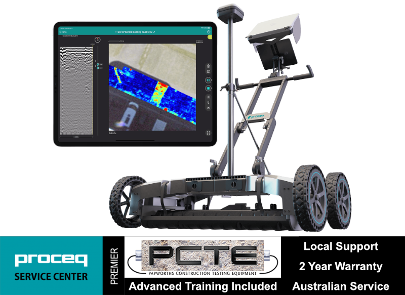
GS9000
Subsurface Mapping GPR
Interchangeable GPR arrays covering a vast array of applications
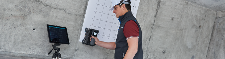
Get an accurate 3D map of the underground, literally, as you walk
Get the most powerful insights from your data, anytime, anywhere
To tackle the big challenge of aging underground infrastructure, Screening Eagle also released the GS9000 Multichannel GPR system to scan large subsurface areas with ease.
The principles of the GS9000 are exactly the same as those that made the GS8000 subsurface mapping system famous - versatility, efficiency and simplicity. Yet with the GS9000, these principles are enhanced to bring new levels of productivity to the field.
The push-operated sensor with Stepped-frequency Ground Penetrating Radar (GPR) scans up to 50 parallel lines at the same and processes them in real-time on the iPad. This enables the same area to be covered up to 30x faster. Buried objects such as utility pipes can be immediately visualized in several ways, leaving no room for guesswork.
The GS9000 offers two interchangeable array options to cover a plethora of applications including bridge and road inspection, forensics, utility mapping, geophysical investigations, archaeology and more.
Applications
- Damage prevention
- Excavation safety
- Utility locating & mapping
- Subsurface utility engineering (SUE)
- Surveying & Reality Capture
- Road inspection
- Bridge inspection
- Geophysical investigations
- Archaeology
- Forensics & UXO
- Precision Agriculture
Specifications
| Radar technology | Stepped-frequency GPR | |
| Array Module | GX1 Array | GX2 Array |
| Modulated frequency range | 500 – 3000 MHz | 30-750 MHz |
| Number of Channels | 35 (VV) + 15 (HH) | 11 (VV) |
| Channel Spacing | 2.5 cm (VV), 5.5 cm (HH) | 7.5 cm |
| Scan Width | 0.85 m | 0.82 m |
| Scan Rate | 25000 scans/s | 22000 scans/s |
| Time Window | 35 ns | 100 ns |
| Spatial Interval | Up to 100 scans/m | |
| Battery | Off-the-shelf power bank x 2 | |
| Autonomy | 6 hours | Hot-swappable | |
| Dimensions | 772 x 1178 x 443 mm | |
| Weight | 45 kG | |
| Wheel Encoders | 2, on rear wheels | |
| Operating Temperature | -10º to 50ºC | |
| Operating Humidity | < 95 % RH, non-condensing | |
| IP rating | IP65 | |
| Connectivity | WiFi, USB-A, USB-C, Lemo (For Positioning) | |
| GNSS Satellites | Multiband GPS + Glonass + Galileo + Beidou | |
| GNSS Real-time Corrections | SSR augmentation or NRTK-compatible | |
| GNSS Real-time 3D Accuracy | Typ. 1-5 cm | |
| GNSS Initialisation | Typ. 5-30 s | |